Improving access to valuable information for the development industry
Published Tuesday, 10 October 2017
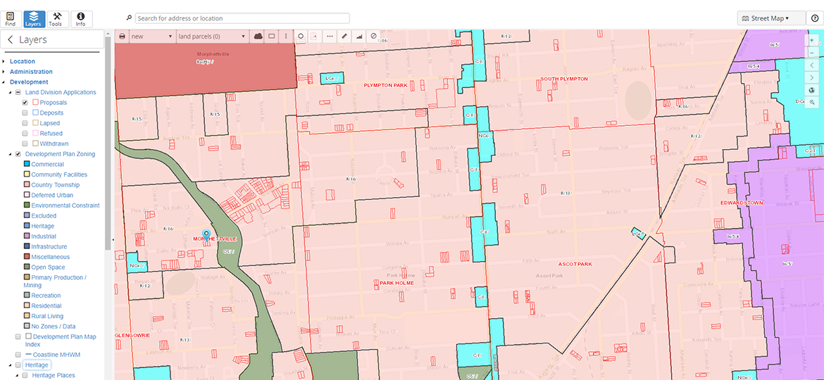
The free map-based online application Property Location Browser (PLB) is a valuable tool used by practitioners in the planning and development industry for identifying ownership and tenure information for new building and development opportunities. It integrates to a number of systems including a direct link to the South Australian Integrated Land Information system.
Its functionality has now been expanded to include:
- planning and building layers such as land parcels, zoning, land division applications, heritage places, environment and food production areas, design wind speeds and bushfire protection areas
- a range of public infrastructure
- ability to access survey mark coordinates and plan references
- capability to search for land division applications using a range of criteria
- user specified buffering features
- utilising satellite, street, topographic and a hybrid of maps for the base layer
- printing of maps.